I’m flying
Surface the terminal, gate, timing, weather, airport map, and what changed—without hunting for it.
birdseye brings the live map, the flight details, and the airport together—then shows you what matters for what you’re doing right now.
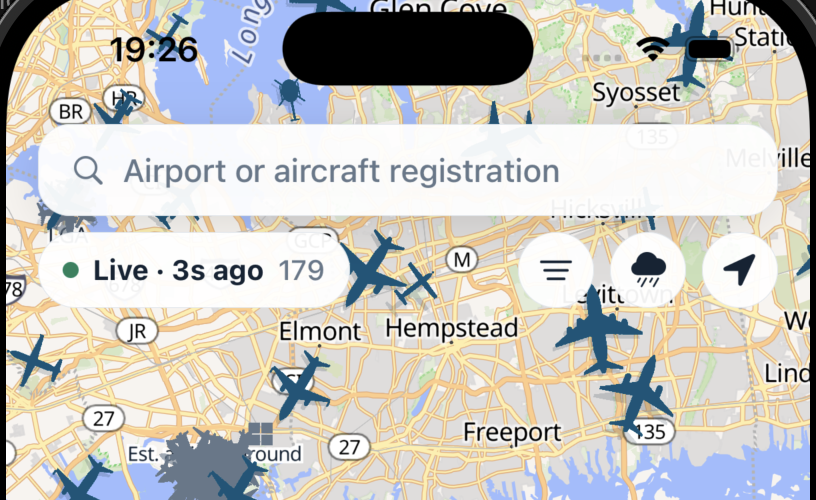
Endeavor Air · N827SK · CRJ-900

The same flight means something different depending on why you care. birdseye starts there.
Surface the terminal, gate, timing, weather, airport map, and what changed—without hunting for it.
Translate arrival data into a practical pickup window, with baggage, gate, and live progress close at hand.
Move from bad news to the best plausible ways forward, ranked by when they can actually get you there.
See dense live traffic, recognize aircraft at a glance, and open the details when curiosity strikes.
Keep your own trip and the people you’re meeting in one place. Dates, scheduled and estimated times, route, intent, and offline essentials stay legible at a glance.
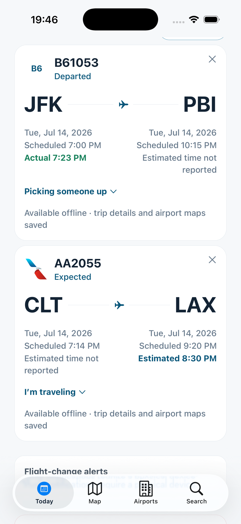
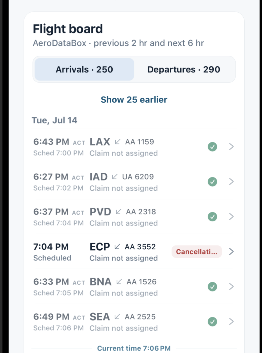
Actual, estimated, and scheduled times stay distinct. Completed movements recede. Gates, claims, incoming aircraft, and live operation status appear where they help.
Honest by design. Scheduled, estimated, actual, live, inferred, stale, and unavailable are never treated as the same thing.
Get current airport conditions first, then unfold the aviation detail. Cloud layers, rain, and thunderstorms become a vertical profile without hiding the source report.
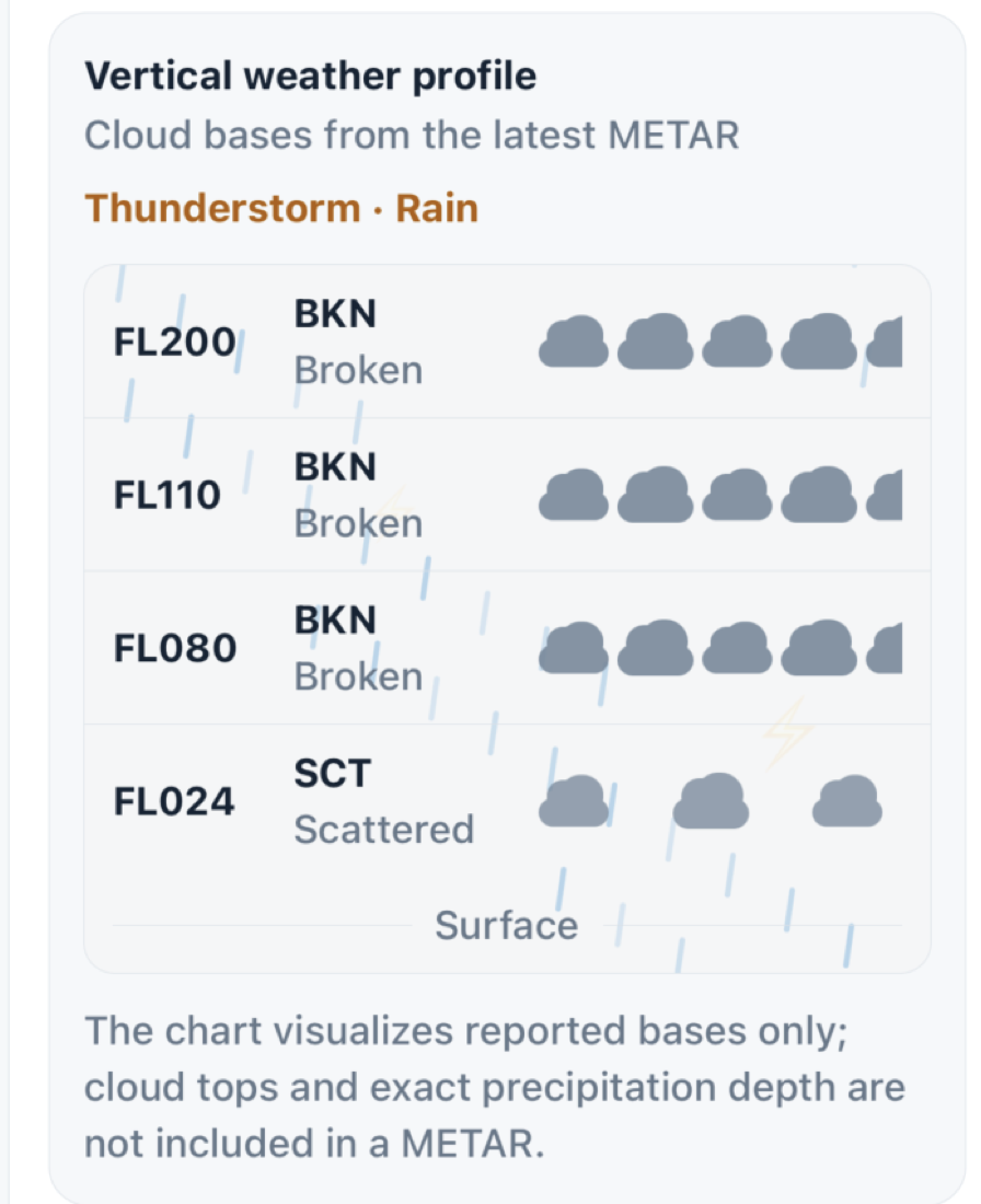
The first view answers the immediate question. Aircraft identity, route history, airport weather, boards, maps, and operational detail are a tap away—not all fighting for attention at once.
A private, family-scale beta is taking shape now. The priority is simple: better information, calmer decisions, and a product that stays delightful even as the data gets deep.